For our nascent nation the Catskills were the first frontier, a vast wilderness across the mighty Hudson just waiting to be explored with high peaks, deep valleys and old growth forests. For me the Catskills are a huge chunk of green seen as a blur from the car window which can be accessed off I-87 via exits 19, 20 and 21. Sad sad. I’ve managed to do only a few trips there since moving to Rye as the two-hour drive was out of my 2:30pm school pickup range. In my NYC thirties I ticked the box on ski trips to Hunter and Windham, a rental cabin in Phoenicia, tubing on Esopus Creek and an ill-fated hike during which I accidentally crossed up and over the mountain and had to depend on the kindness of strangers to get back. (Amazingly my hero was a gentleman who had hitchhiked his way around the world right after WWII and showed me all his scrapbooks while his wife made us tea. There truly is a special God for children, drunks and hikers). But I haven’t quite pieced it altogether. It’s huge. Where to begin? With a topo map the size of my kitchen island and a pen.
The range, part of the Appalachian Mountains, is divided into two parts: Catskill Park and Catskill Forest Preserve. In 1885 New York State drafted constitutional protection for 700,000 acres sprawling across the region in order to manage and preserve the land from logging and tanning industries. The “frontier” was being decimated. The Park is a mix of public and private land, defined by the “blue line,” a boundary the state established in 1904. The Preserve includes 287,000 acres of state-owned land within the Park that is protected as “forever wild.” It all remains pristine and wild to this day, and there are hundreds of adventures to be had.
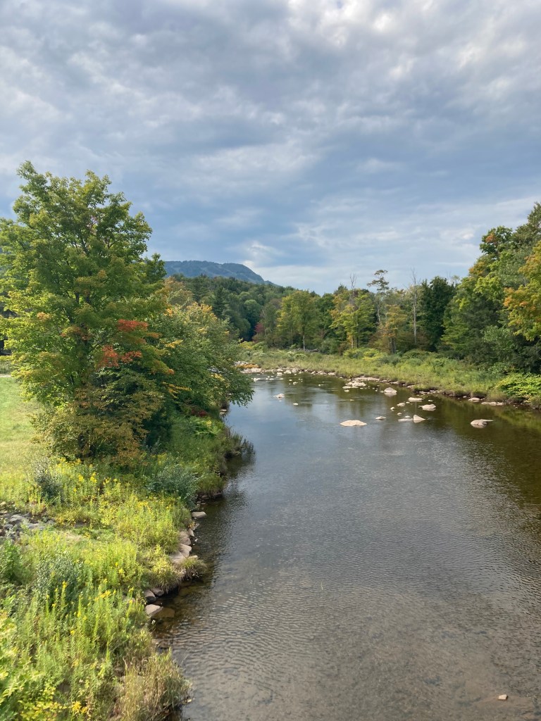
I started at Exit 20 (the Saugerties exit) on a guided hike with Destination Backcountry Adventure (DBA). Local knowledge is imperative for a newbie, and our guide Brad was a fount. We had a lovely hike up Plattekill Clove on the eastern edge of the Catskills Escarpment then lunch with a view of the Hudson from Codfish Point. We were literally sitting on the edge of the mountain range and looking east. We made good time, so we returned to the trailhead and made the short hike up to Plattekill Falls for a bracing swim in our undies (well, some of us).
Coming down the mountain after our hike, I apparently took a wrong turn through a time warp. I stumbled upon a farm with men, women and children in garb from a past era. Completely fascinated, I researched when home. My wormhole was the Plate Cove Bruderhof (German for “place of the brothers”) which is home to a group of Hutterites, “a Christian community which renounces private property and share everything in common”. They are akin
to the Amish and Mennonites in that they come from the same post-Reformation religious movement known as Anabaptist (requires adult baptism) and embrace pacifism. But the groups have diverged. Hutterites embrace technology. They dress plainly, but use modern farming equipment, Internet, television, and all modern amenities. A commune is usually a farm or manufacturing operation where everybody works together as a unit (my wormhole experience). They were super friendly and are open to visitors (pre-scheduled online at www.bruderhof.com).
I completed my day with a drive-about, a stroll through Phoenicia, a visit to the Catskills Visitor’s Center and a dip in Esopus Creek under Highway 28 with all the teenagers from town. I can currently offer only this one solidly researched adventure, but I’m planning my Westward expansion. As our forefathers did.
Daytrip: Lovely and easy hikes along Plattekill Clove from the Codfish Point Trailhead include a 1-mile round trip to Plattekill Falls, 4-mile round trip to Codfish Point or 6-mile roundtrip to Echo Lake.
Directions to Codfish Point Trailhead (Platte Clove Road, Elka Park, NY): North on Interstate 87 to Exit 20 for NY-32 toward Saugerties. Left on NY-212 West/ NY-32 North. Slight right on Blue Mountain Road. Right on Harry Wells Road. Left on Carrelis Road. Left on Reservoir Road. Left on Blue Mountain Road/Cemetery Road. Right on West Saugerties Road (becomes Platte Clove Road) which winds 4.3 miles of up up up switchbacks to trailhead on left. Not for the faint of heart. There’s room for about 10 cars on left side of road. There’s also a small parking lot just past this at Huckleberry Point Trailhead on the left. This road is closed November to April.
Overnight: Emerson Resort and Spa in Mt. Tremper has plenty of room at the Inn and cheaper ones in the Lodge. Get driving directions from concierge if you do Codfish Point Trailhead as you’ll be approaching it from the other side of the mountain. If you bust outta the compound for meals, do breakfast at Phoenicia Diner and after-hike beers at Sportsman’s Alamo Cantina (biker heaven) or Woodstock Brewery.
Kaaterskill Falls is a classic Catskills hike, heavily trafficked as easily accessible from the Mountainside Historical Society (5132 NY 23A, Haines Falls). Park and walk the rail trail about a mile to the observation platform at the top of the falls. There is also a large parking lot on Laurel House Road for trail to same platform. For trail down to bottom of falls, cross Spruce Creek and look for signs. Be careful as can be slippery.
For a stroll: Mountaintop Arboretum on Maude Adams Road in Tannersville.
For beer: West Kill Brewing (trailhead parking lot for 1.7-mile hike to Diamond Notch Falls is about a mile and a half east of brewery on Spruceston Road) or Rip Van Winkle Brewing Company. Further down the road (for another trip) are DBA Brad’s favorites: Subversive Brewery in Catskill and Arrowood Farms in Accord.
For gear: Kenco Outfitters, 1000 Hurley Mountain Road, Kingston.
For guidance: Destination Backcountry Adventures. Thanks for the local knowledge, Brad!

Leave a comment